Hiking ideas for European summer 2026 (ongoing draft)
Plan for a couple weeks in June, then sometime from start September to start November while J in CA.
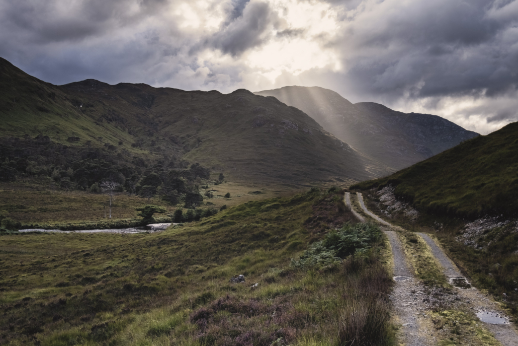
Peaks of the Balkans
- Peaks of Balkans
- 192 km
- 10,000m gain (52/km)
- Trail length: 192 kilometers (119.3 miles)
- Min. elevation: 670 meters (2198 ft) | Max. elevation: 2,290 meters (7513.12 ft)
- Ascent: 9,800 meters (32152.23 ft) | Descent: 9,900 meters (32480.31 ft)
- Time: 10 days
- Navigation: marked
- Seaons: mid-June to October
- Cash not cards
- Most go anti-clockwise
- Border permits in advance
- Or Zbulo
- Best entry points
- Fly to Podgorica > bus to Plav
- Fly to Tirana > ferry to Valbona
- Main resupply points:
- Plav: large supermarkets
- Theth: small supermarket with basics
- Valbonë: small kiosk
- Peja: large supermarkets (30 minutes by car from trail)
- Dugaivë: vending machine
- Budget
- Cost: ~€1000. Based on:
- 10 x guesthouses – €50 half board = €500 (consider camping depending on resupply costs)
- 10 x lunch/snacks – €15 = €150
- 3 x border crossings (via Zbulo) – €5 = €15
- SIM card €15 for 15 days = €15
- 2 x bus/ferry Tirana > Valbona – ~€30 = €60
- Return flights LON > TIA – ~£150-200
- Time: ~14 days (inc travel, chills)
- Cost: ~€1000. Based on:

Route modifications
From https://hikingandcoding.com/2018/09/17/peaks-of-the-balkans/
However, it is worthwhile deviating from the official route for two reasons.
The first reason is that the official route does not pass through the stunningly beautiful [Prokletije National Park.](https://www.visit-montenegro.com/tourism/national-parks/prokletije/) You simply must add this to the itinerary as a side trip from Plav. This park contains the most splendid and rugged section of the Accursed Mountains, and there are some breathtaking day hikes here. Accommodation is very scarce, and reservations (or a tent) are essential.
The other reason is that the official route includes some mind-numbingly boring parts over tarmac roads with nothing to see. Some have speculated that this is to give equal parts of the route to each of the three countries. Whatever the reason, you should arrange a taxi to skip these boring parts. It is worthwhile to book these taxis in advance because they are not easy to arrange on the spot, even if you have a local cell phone. The day-by-day itinerary below describes which sections to skip
Seems like a lot of people cut off much of the Kosovo section but Mt. Gjeravica seems worth a detour.
From https://uncorneredmarket.com/peaks-of-balkans-trek-beginners-guide/
Valbona to Çerem, Albania: There is the standard Peaks of the Balkans route to get to Çerem, but we suggest you take the trail that goes through Qafa Perslopit and Stanet e Derzhanes. You begin from Valbona with a steep 1200m/2900 ft climb from Valbona, but the trail is beautiful and is worth the effort.
Not only can you enjoy great views of the granite peaks of the Accursed Mountains, but you cross high pastures filled with shepherds’ huts. You may even find yourself welcomed in one of them for coffee, as we were.
Mt. Gjeravica, Kosovo: This trail from the shepherd village of Dobërdol, Albania will take you across several mountain passes, valleys and lakes to finally reach the summit of Mt Gjeravica, the highest peak in Kosovo (2,656m/8,714ft). The views from the top, especially of the turquoise alpine lakes below are impressive. If you are interested in taking this side trip detour, you’ll need to arrange transport from Gropa Erenikut.
Vermosh–Mt. Grebenit–Lëpushë–Mt. Talijanka–Grbaja Valley, Albania and Montenegro: We’re actually surprised that this two-day route is not part of the standard Peaks of the Balkans route as it has, in our opinion, some of the best mountain views in the area.
You can add this on easily from Plav, Montenegro, by hiring a taxi to take you over the Albanian border towards Vermosh village. From there you can find the trail to Mt. Grebenit and finally to Lëpushë where you rest overnight before climbing Mt Talijanka the next day. The descent from this peak features the stunning granite peaks of the Karanfil Mountains on the border of Albania and Montenegro.
Useful reads
- https://jontynz.com/2024/04/22/things-i-learnt-hiking-the-peaks-of-the-balkans/
- https://www.thenaturaladventure.com/tours/albania/peaks-of-the-balkans-extended-route/
- https://www.thehikinglife.com/2024/10/a-quick-dirty-guide-to-the-peaks-of-the-balkans-trail/
Starting point
Most agree the ferry ride to Valbone is amazing so best to start from there.
From: https://albaniatourguide.com/how-to-get-from-tirana-to-valbona-bus-car-ferry-taxi/
Tirana to Valbone
Step 1: Bus from Tirana to Koman
The daily bus from Tirana to Koman departs from the Gazheli Petrol Station in Tirana. You can see the location of the Gazheli Petrol station in Tirana on a Google Map here: https://goo.gl/maps/ethGMoaRLSTqxrQU7
The petrol station is close to Tirana Ring Center, which is a shopping mall next to a large roundabout. You can recognize the roundabout because it has a large silver artwork in the middle.
The bus from Tirana to Koman departs once a day at 5 AM in the morning. The bus has to leave that early because the Lake Koman Ferry departs at 9 AM. And it takes 4 hours to drive from Tirana to Koman.
A bus ticket from Tirana to Koman costs 10 euros. But you can also book the total package from Tirana to Valbone for 24 euros. If you buy the total package from Tirana to Valbona, this includes the bus from Tirana to Koman, the Lake Koman Ferry, and the bus from Fierze to Valbona.
The bus from Tirana to Koman is a shared minibus, if you prefer a private transfer, then more information is below.
You can book the bus transfers and the Lake Koman ferry ticket on the website of Koman Lake Ferry here -> https://komanilakeferry.com/
The bus from Tirana to Koman will drop you off at the Lake Koman Ferry terminal, you can see the location on a Google Map here: https://g.page/KomaniLakeFerry?share
Step 2: Ferry from Koman to Fierze
The Lake Koman ferry departs every day at 9 AM in the morning. The Lake Koman Ferry starts from the terminal in Koman and brings you to Fierze. The boat journey lasts approximately 3 hours.
The ferry starts from the Lake Koman Ferry Terminal, which you can see on a Google Map here: https://g.page/KomaniLakeFerry?share
And at the end of the trip, the ferry boat drops you off in Fierza, which you can see on a Google Map here: https://goo.gl/maps/Z8Qv245tNKLyWSN58
The ferry boat journey from Koman to Fierze costs 8 euros per person for a one-way trip. But you can also buy the total transportation package from Tirana via the Lake Koman Ferry to Valbone, which costs 24 euros. This includes the bus from Tirana to Koman, the ferry from Koman to Fierze, and the bus from Fierze to Valbona.
The ferry trip from Koman to Fierze is an absolute highlight. This boat trip was originally intended as a way for locals to travel around the area when the area was flooded and the dam was created. However, the ferry boat trip on Koman Lake is so beautiful, that tourists from all over the world came to visit this spot.
Bradt Travel Guides describes the boat trip as “one of the World’s Greatest Boat trips”. And the Lonely Planet Guide always has the Lake Koman Ferry in their list of highlights for Albania. So making this boat trip is a long day with an early start, but very well worth it!
Step 3: Bus from Fierze to Valbona
The Lake Koman Ferry departed from 9:00 AM in Koman and around 11:30 AM, you will arrive in Fierze.
In Fierze, there is a small coffee house, and a toilet and there are a few busses waiting to bring passengers from Fierze to Valbona.
The bus from Fierze to Valbone costs 7 euros per person. But you can also buy the total transportation package from Tirana via Lake Koman to Valbona, this costs 24 euros per person.
The bus from Fierze to Valbone is a shared mini-bus, if you prefer a private transfer, then you can find more information below.
You can make a reservation for the Lake Koman Ferry and the bus journey together on the website of Koman Lake Ferry here: https://komanilakeferry.com/en/
The bus from Fierze to Valbone will drop you off at the Hotel Rilindja in Valbone. So it makes sense to make a reservation at Hotel Rilindja to make your trip very easy and convenient. You can see the location of Hotel Rilindja in Valbona on a Google Map here: https://goo.gl/maps/Hc1RBp3PbKW9P9mf8
Long Crossing of Lofoten
- Note: you would need to be in seriously good shape
- 100 km
- 9,193m gain (92/km) (another resource says 6,900m!)
- Min. elevation: 0 meters | Max. elevation: 1,029 meters
- Time: 11 days (8-11 in some sources but it looks hard as fuck)
- Navigation: unmarked
- Season: mid-June to late September
- Card-friendly
- GPX
- SOBO marginally safer (less steep descents)

Main resupply points:
- Stage 1: Sandsletta Camping (restaurant/shop)
- Stage 2: Svolvær (town)
- Stage 4: Leknes (town)
- Stage 5: Nusfjord (village)
- Stage 6: Ramberg (village)
- Stage 10: Å (village)
Costs
- £1000 based on:
- Return flight LON > Bod = £300
- 11 x daily food – £15 = £165
- 5 x dinners outs – £40 = £200
- 4 x buses – £15 = £60
- 1 x ferry (only if you want to reserve – it’s free to walk-on but risky) = £20
From 68north.com
Note: 100 NOK = £7.50-8.00
If you are carrying a tent and willing to camp and hitchhike your entire time on the islands, then it is very possible to get by on a budget of less than 100 NOK/day, which would more or less be purely food costs and maybe a bus ride here or there and one night at a campground over the course of a week.
If you are still willing to hitchhike most of the time, but might take a bus or two and want to stay at a campground or hostel a couple times per week, then you are looking at a budget of around 150-200 NOK/day (averaged over a week).
If you’re mostly going to be staying at campgrounds or hostels and will utilize buses for most your travels, and want to eat semi-decent food for dinner, then budget for around 200-300 NOK/day.
Never go anywhere near a restaurant or pub. Seriously!
Hostels:
- Stamsund – 160 NOK/night – March – October
- Å – 250 NOK/night – Year round
- Ballstad – 240/night – Year round
Classic Stages
[thanks https://www.hikingfex.com/en/post/lofoten-crossing-trekking]
- Delp – Sandsletta (13 km and 800m ascent)
- Sandsletta – Svolvær (13 km and 600m ascent)
- Svolvær – Kleppstad (16 km and 500m ascent)
Bus: Bus stop Kleppstad with bus 741 to Bus stop Vikjord (the journey takes 1 hour and 40 minutes). Alternatively, you can organise a lift across the bridges. If you have the necessary change, you can ask people directly at the rest area in Kleppstad. - Vikjord – Store Krenggårsvatnet (19 km and 1260m ascent)
- Store Krenggårsvatnet – Leknes (12 km and 140m ascent)
Bus: Bus stop Leknes sentrum to Bus stop Napp with bus 742 or 300 (the journey takes 15 minutes) - Napp – Nusfjord (17 km and 600m ascent)
- Nusfjord – Ramberg (19 km and 210m ascent)
Bus: Bus stop Ramberg with bus 771 to Bus stop Fredvang nord (the journey takes 20 minutes). Alternatively, you can cross the bridges on foot, but be aware of the traffic as there is only a very small pavement for pedestrians. - Ramberg – Selfjord Bay (18 km and 680m ascent)
- Selfjord Bay – Kirkefjord Ferry Terminal, then continue by ferry to Tennesvann kraftverk (departure usually at 3 p.m.) – DNT Munkebu (23 km and 1150m ascent)
- DNT Munkebu – Ågvatnet (14 km and 650m ascent)
- Ågvatnet – Å i-Lofoten (12 km and 770m ascent)
Useful reads
- https://www.thehikinglife.com/2020/02/the-long-crossing-of-norways-lofoten-islands/
- https://rando-lofoten.net/index.php?lang=en
Side quests
- Reinebringen (from A Lofoten)
- See Swami’s list of alternates
Kungsleden
- 460 km
- 100 SEK = ~£8.00-8.50
- Season: Mid-June to late September, with late August to September offering fewer mosquitoes and stunning autumn colors
- Carry cash for huts


Leave a Reply
Want to join the discussion?Feel free to contribute!